
Politics
🇰🇷 South KoreaSeoul's Rapid Development Turns Han River Into Canyon Between High-rise Apartments in South Korea
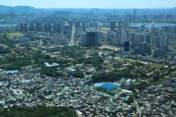
Seoul is a rare metropolis blessed with natural beauty, but rapid development is turning the Han River into a canyon between high-rise apartments, raising questions about the city's future as the government and city hall debate expanding housing supply. Unlike New York, Rome, or Paris, Seoul's unique geography — Bukhansan and Gwanaksan mountains framing the Han River — has been a defining feature of the 600-year-old capital. The city's original boundaries were set by Bukhansan to the north, the Han River to the south, Jungnangcheon stream to the east, and Moraenae to the west.
After Japanese colonial rule, the city expanded southward, placing the Han River at its center. However, decades of dense development have obscured the mountains from view. The Han River is turning into a canyon between high-rise apartments, the column notes, with increasingly massive buildings blocking sightlines that once offered views of Bukhansan from Olympic-daero and Gwanaksan from Gangbyeonbuk-ro.
The debate centers on Yongsan Park, where Mayor Oh Se-hoon appears to hold the upper hand. Citizens have long desired to transform the former U.S. military base into a public park, but the mayor's plan to build housing there has sparked controversy. The column argues that the city must balance development with preserving its natural landmarks, warning that unchecked construction could permanently damage Seoul's identity. The outcome of this debate will shape not only the skyline but also the quality of life for millions of residents.
Source: Hankyoreh EN
Most read in this category
Loading article…